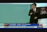
gale warnings and high wind warnings up for the higher peaks of the sierra nevadas. gusts could cause damage there. water vapor imagery showing you a second surge of moisture coming in now. that will start in seattle and slide down to san francisco. the main mother of all these storms is sitting off shore, not moving all that much. that's why we will continue to see these pulses spiral in from time to time. i-5 corridor, heavy rain about to move into the shoreline. snow at the higher elevations. this is a pretty warm sector storm. snow levels will be fairly high and temperatures out ahead of this system will be warm, especially in the four corners and inner mountain west. eight to 10 inches of mostly rain. flooding, yes. also the possibility of seeing some debris flows and mudslides all the way down south of san francisco. you have to go up to really 7,000, 8,000, 9,000 feet to get into the snow zone. it will be a four, five, six-day event, carol. with these lines packed closer together, that means wind as well. several punches to go before it's all done beginning ne
 Live Music Archive
 Librivox Free Audio
 Metropolitan Museum
 Cleveland Museum of Art
 Internet Arcade
 Console Living Room
 Books to Borrow
 Open Library
 TV News
 Understanding 9/11